
Itinerary of the Via San Francesco 2013.
This was a wonderful camino, walked over two weeks in late May 2013 with Jacqueline, Sebastian and Andreas, three friends from Camino de Santiago 2011. They’re a fun bunch and it was a joy to share with them. To read our story from the beginning, start here.
Our biggest challenge was lack of adequate guidebooks in English. There’s a somewhat dated (2010) German guidebook, which Sebastian brought with him, but otherwise we depended on websites that covered only portions of the path. They seem basically to be divided by province, with a few sites describing the trek in Umbria and others describing the way through Lazio. And the path wasn’t exactly straight, either. The traditional St. Francis walk starts in Assisi and ends in the Rieti Valley, making a loop between Pogglio Bustone and the town of Rieti. So with this walk we cut through the St. Francis loop and headed to Rome. And of course, Rome never disappoints!
The main sites that have maps and guides are:
- La Via di Roma/La Via Francigena di San Francesco site, which includes a detailed itinerary and maps from the Umbrian tourist bureau; and
- The Camino di Francesco site, which some rough maps and walking directions.
That’s a lot less info than for any other camino I’ve ever taken. So. . . . . the iPhone and Google Maps kept us out of trouble some of the time. A small price to pay for a truly beautiful walk.

Jacqueline and I in the Vatican after a successful adventure acquiring our Testimonia.
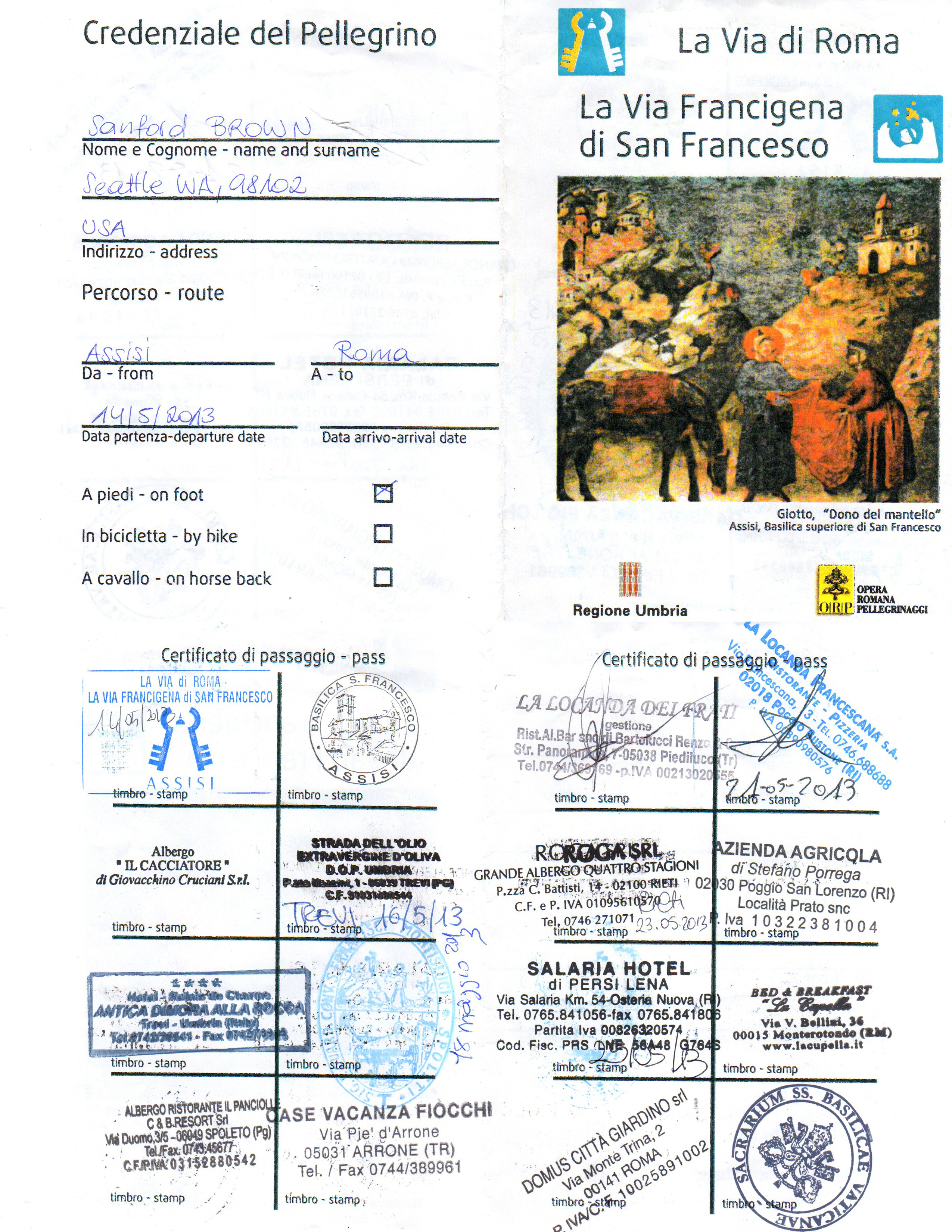
2013 Credential from Cammino di San Francesco
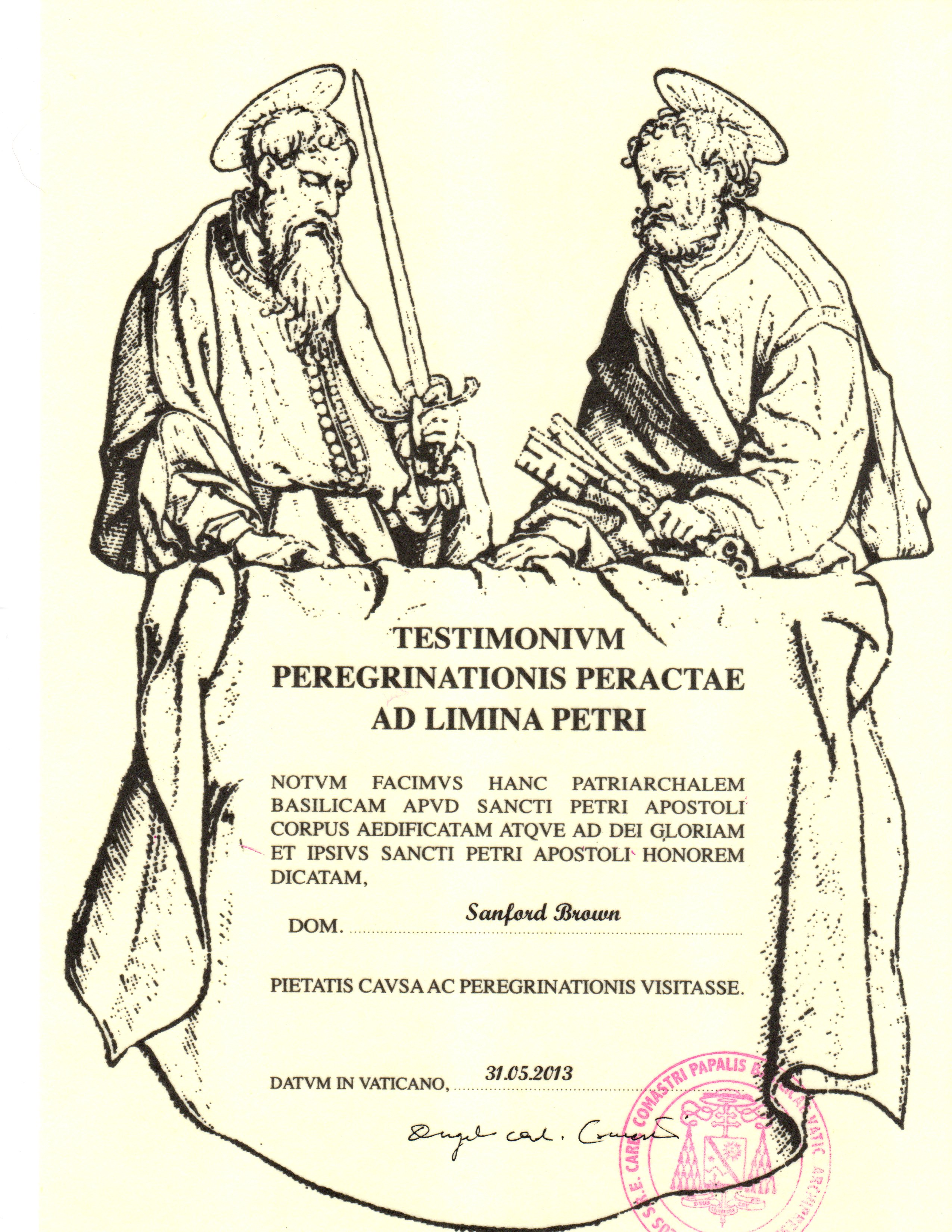
Testimonium from the Vatican following our 2013 Cammino di San Francesco

Hi. Currently on via di San Francesco in Consuma. I started in Firenze. I wanted to share that the CAI 11 markings are lacking as we turn up to go to Consuma. It appears that they are cleaning up as is evidenced by logging activities. I turned back thinking I was on the wrong trail but started noticing orange arrows painted on the path rocks, similar to the Camino de Santiago arrows. Even in the places that could be confusing, the arrows point you in the right direction. The shortcut was missed but I had been on that same road a few weeks ago with a local. The gps maps don’t work as well in that area, at least it didn’t today. The page of the book now looks well used, somewhat in pieces! The walk was simply amazing even with fewer markings. Thanks
I’m so glad to hear this info. Thank you! BTW the orange arrows are for the Via Ghibelline, which also goes through Consuma and then on a different path to Santuario della Verna. So I’m glad they worked out for you! Please do keep sending info like this. Thank you and God bless!