-
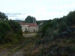
- Quiet village on the way to A Gudina
-
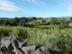
- Beautiful scenery on the way to A Gudina
-

- Opcion at A Gudina. I went right.
-
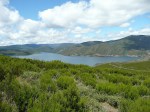
- View to largest man-made reservoir in Spain.
-

- Looking down to Campobeceros
-
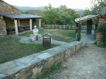
- Ran out of daylight, so stayed overnight at this pilgrim picnic shelter.
This very challenging and frustrating day began with a nice breakfast at the Vilavella Hotel. Along with ordering a few croissants I had the waitress make a bocadillo to go. She made an enormous one of turkey, cheese and tomatoes. This would come in very handy later.
I left the hotel at 07:30, walked downhill through town and caught the camino at the base of the village. The next 14 kms were a delight as I passed farm after farm, nestled between creeks, with ancient stone walls separating them and huge, light brown cows watching my every move until I passed by. After 14 km the path veered out of the verdant area and joined the highway.
In about a km the town of A Gudina came into view. Since it was only 11:00 I was torn as to whether I’d continue on or stay in A Gudina as planned. I sat on the sidewalk and considered my options as I ate half my bocadillo. The next village with services would be Campobecerros, 23 kms away. It would take me 5-6 hours to walk and I’d be gambling that the town’s one hotel would have a room available. Still, it was only 11:00. Finally I decided to go for it, and I entered the town to get extra food and water. By noon I was on the road with fruit, more water, and two nice looking chocolate croissants.
After leaving A Gudina the camino joined a secondary road following a high ridge at 1000 meters +/- elevation. It would follow this road for about the next 12 kms, crossing tiny hamlets one by one. The gravel road then cut across a ridge and soon began a quick descent on loose shale to Campobecerros where I arrived at 18:00.
Exhausted, I stopped for a beer at a tiny bar, then found the hotel. I asked for a room and was told to sit and wait for a few minutes. Twenty minutes later, still no room. I asked what was going on and was told they had no rooms. By this time – 18:45 – I was getting concerned. I knew it was 14 km to the next town with services, Laza. That would take over 3 hours to walk, and I knew it would be too dark to walk by 22:00. I asked if they could call a taxi to take me to Laza, and they agreed. No answer from the taxi driver. Just wait a few more minutes they said. Got hold of the driver. He’ll be here in maybe 20 minutes. By now it was 19:15 and, frustrated, I decided to hit the road and use what little outdoor camping gear I had with me if I couldn’t get to Laza before nightfall. I wasn’t sure why it had been so difficult to communicate with the staff at the restaurant, but I chalked it up to the Spanish/Galego language difference.
I made it 8 km downhill before my body just could not go farther. At the town of As Eiras, 44.6 kms and 14 hrs after I began, I found a camino rest area with three covered picnic tables. I slept the night on the westernmost table with the sun’s last glow on the horizon and a crescent moon in the southwestern sky, typing a note to Gail on my iPhone in my sleeping bag atop my sleeping pad at 22:36 in the evening. Beautiful pine forest was around me here, with the tiny village seemingly deserted, at least from the vantage point of this tiny picnic area on the outskirts of town. Next village, Laza, is 6 km away. Too far that night for this tired body.
