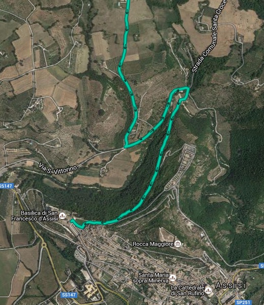
It’s now possible to download GPX tracks that cover the exact route of The Way of St. Francis book. Here’s how to do it:
You will need to purchase the book and create a Cicerone Library to collect the GPX files.
- Go to the the books website at Cicerone.co.uk
- Go to the link toward the bottom of the page marked “Downloads.” Click.
- When you click on GPX downloads the site will send you to a “Sign-in or Register” page
- Once you’ve signed in or registered you’ll be returned to the GPX download page.
- Now you’re able to download the tracks.
Congratulations!

Cannot find the latest GPS file.
Hi Georgette ~ Can you say more? Have you gone to the Cicerone site?
Hi Sandy,
I’ve downloaded the GPX-files from the Cicerone site, but it seems something went wrong with the second track. When I upload it in Viewranger it is called ‘Bridge closure detour track’ and it’s only a short track in Spoleto Can you maybe help me with the complete track?
I gonna walk the full track in May, really looking forward to it, thank you for the nice guide and the updates, not to forget the accommodation list!
Kind regards,
Maartje Betlem
Hi Maartje ~ The GPX files have several tracks included. It’s possible that ViewRanger doesn’t allow importing multiple tracks in a single file. You might want to consider using a different GPS app, such as Galileo Pro, which has no problem with multiple tracks.
Hi, do you have any suggestions as the best GPX viewers for Android currently? We are walking the Francescan Way in May 2020, used to using paper maps, and new to using GPX data.
Sure! I recommend Guru Maps. Here’s a link to their Google Play site https://play.google.com/store/apps/details?id=com.bodunov.GalileoPro