Ancient fortresses, bridges, roads … and bathrooms


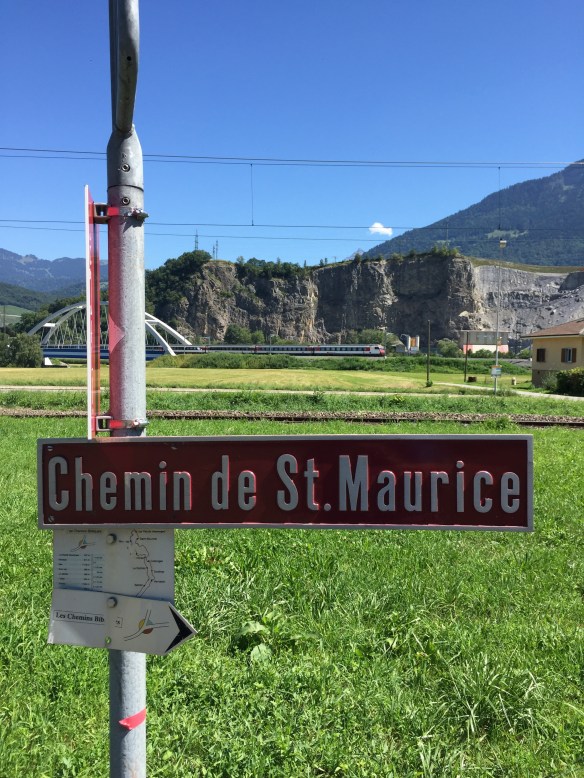
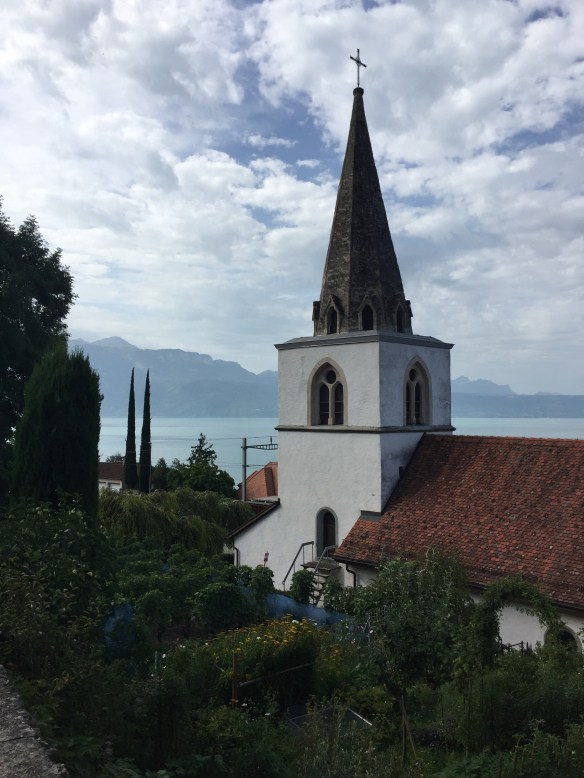
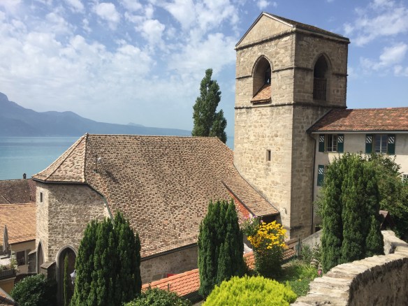
Day Eleven: Chatillon to Pont-Saint-Martin (Carema) 37.5 km (23.3 miles)

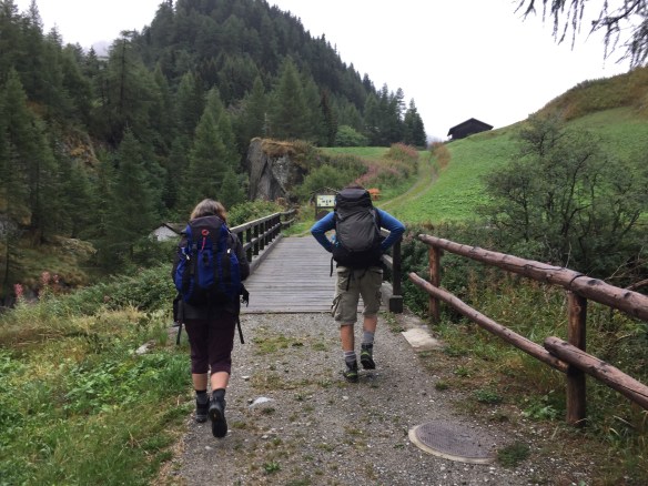
When I left Chatillon this morning I wasn’t quite sure where I’d spend the night. I’d been rebuffed at Verres, the official end of stage. Everything was full. As I made my way a few kilometers after breakfast to Saint-Vincent I met two pilgrims — Morgan of Belgium and Roberto of Milan — who suggested I join them at the parochial hostel in Donnas, about 28 km down the road. That sounded like a good idea, so while we were talking I phoned in a reservation.

Morgan and Roberto soon turned left, uphill on the official walkers’ route. I’d researched the lower, easier bicycle route and headed downhill to the valley floor on my own.

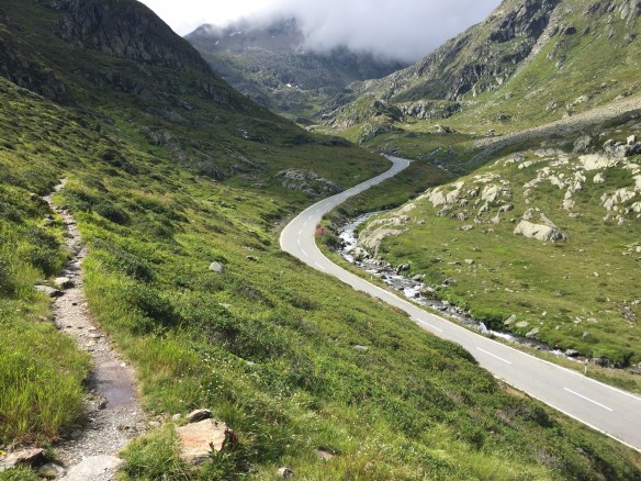
The cycle route ended up being delightful. It mostly hugged the river, giving me a vantage point uphill to the mountains on both sides. I reached Verres about noon, met a Dutch pilgrim there named Derek, and explored the town a little before heading back to the bike trail, assuming that Morgan and Roberto were far ahead.

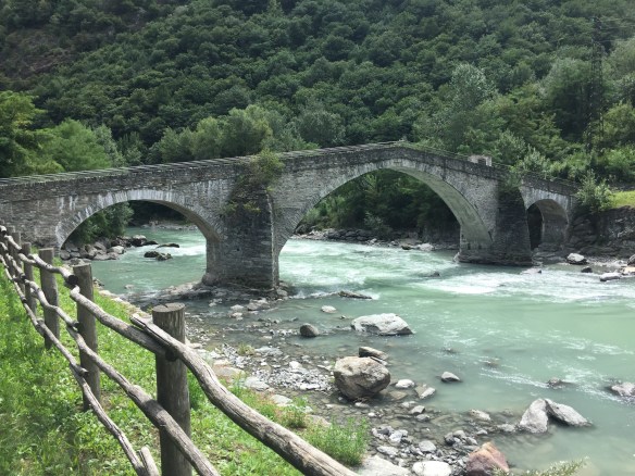
I then spent the day in occasional shade, on gravel roads with riverfront trees shielding me from the hot sun. I walked by the Saint Germaine Castle, and later the amazing 17th century Ponte di Echallod bridge. After that I enjoyed views of the Bard Fortress, a medieval castle destroyed by Napoleon in the early 19th century then rebuilt. The little touristy-medieval town of Bard was a delight as well, and just afterward was a brief stretch of original Roman road.

By 4:30 I’d arrived at the parochial hostel in Donnas with no sign of Morgan and Robert. Since no one at all was there I had a little time to explore. Eight beds in four twin bunks. A hot plate for cooking, and the most antiquated bathroom I’ve seen in all of Italy. The toilet was a hole in the floor and on the left wall of its cubicle was the shower head. The toilet/shower was separated from the janitor’s/guests’ sink by a bright, plastic curtain, and the light bulb for seeing it all had inhaled its last breath.

I’d already walked 31km, so this whole arrangement seemed unfortunate, but serviceable in a pinch. Except — there was no soap to be found anywhere. Not a bar, not a bottle, not a dispenser of the liquid variety. I had none in my pack. Nothing. And considering the poor performance of my deodorant I was in a bind. I could not imagine climbing into my sleeping bag liner as dirty as I was. Since I was alone in the hostel (had Morgan and Roberto opted for something less basic?) there were no other pilgrims from whom I could borrow some.

My solution was to walk into Pont-Saint-Martin to find a bar of soap. The only problem? On Sunday everything is closed. The farther I walked the more I thought the hostel was a bad idea. I checked the Internet, found a cheap hotel available in Pont-Saint-Martin, made the reservation, and after I returned to the hostel and was packing up, who should arrive at the hostel but Morgan and Roberto? They looked pretty good after a long day on the upper route, but I noted that even though I’d lazed around in Verres, the bike route put me in Donnas about an hour earlier.

Though I’d have loved to spend the evening with them, especially if they were equipped with soap, I said goodbye and headed the three additional miles to my hotel. As I unpacked, wrapped a clean towel around my and walked a few steps to the shared bathroom occupied by someone else in the four rooms on this floor, I was startled to see Charles, who’s staying two doors down at the hotel. I’d ended up catching up to him by walking a long 37 km today. Though I loved seeing him (we’re having breakfast together tomorrow) it was the soapy shower that made my day. So many suds from that little white lozenge. And the bathroom? Why, there was even a separate shower and toilet.

Hiking Notes: I’m wishing I’d called lodging a day ahead as it seems some of the pilgrim hostels are filled by non- pilgrims. To me, the bike path was just fine and looking at the elevation profiles from the guidebooks I’d say it was a lot easier that’s the official walkers’ route. Plus the two do intersect frequently.


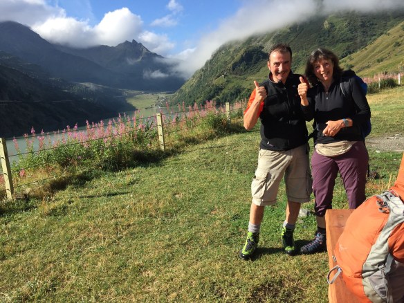
Mirning vista near San Vincent

Roberto (l) and Morgan
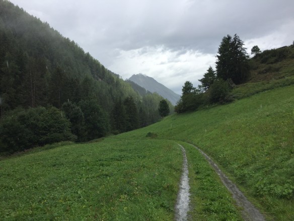
The valley.

The bike path. Not too shabby.

View back to 17th c. bridge.


Castle alert!

Fortress Bard

The 2,000 year old “pont” of Pont-Saint-Martin.

Aching legs, shortcuts and a surprise visitor

Fresh snow in the mountains above Aosta.

Day 10: Aosta to Chatillon — 31.9 km (19.8 miles)

I’m not sure how I finally managed to drag myself out of Aosta. When I woke up my legs were stiff and achy, I’d been in my room for two nights and had made a cozy little home of it, and my cell provider decided for an inexplicable reason to cut off my data signal. That last problem would mean I couldn’t leave town until stopping at the TIM cellular outlet, which would make my annoyingly long day even longer. As 7:00 turned to 8:00, my bed felt so comfy. As 8:00 turned to 9:00 I begrudgingly packed, paid my bill at the front desk, and made it out the door on stiff legs.

The cell problem took only a few minutes, but waiting for the office to open had cost me two preciously cool morning hours. With 30 km ahead, that would put me at Chatillon at around 5:00. A long day, warmed by a steady drop in elevation.

To skip the hectic valley floor the Via Francigena stewards put the official route onto an up and down series of trails and roads that traverse the valley’s steep northern wall. My guidebook offered an alternate that was lower and easier, if not shorter. My stiff legs and I opted for the lower route, which I would discover was still plenty scenic. This would mean a day spent on asphalt, something always tough on the feet. It would also mean the pleasant prospect of a daylong march through a nearly seamless parade of Alpine villages. The place names give away their French influence — Angelin, Clappy, Olleyes, Rovarey, Torrent, and many more. So I set out from Aosta under blue skies with visions of my comfy bed still filling my mind.

After a couple of hours I spied another pilgrim, Sergio, from Colombia, who had set out from Canterbury over a month ago. He had also opted for the lower route and after a fun chat and photo, he took off down the hill, headed for another 5 km beyond my planned overnight. I would see him again at lunch in Nus and am guessing that due to his pace that may be the last time.

The lower route crossed the Dora Balthea River — the main waterway in the Aosta Valley — at the touristy village of Feniz, with its charming fairy tale castle. A bonus for taking it easy!

It was somewhere around Arlier where I spied my surprise visitor — a gorgeous, red fox — little smaller than our northwest coyotes, and really rather pretty. He silently crossed the road ahead of me and disappeared into some bushes. Of course he considered me to be the visitor, I’m sure, but I appreciate how unusual it is to see one of these clever animals in the daytime and feel a little blessed.

After what seemed like forever I finally crossed back over the Dora Balthea into the foot of Chatillon. I’m not sure why they put the town’s cathedral at the very top of the town, but my legs allowed me to walk up there for a couple of photos of the church and the gorgeous valley below. Overall a long and hot day, but one full of interesting scenery.

Hikers’ notes: I’m not sure the value of Alison Raju’s lower option from Aosta to Chatillon. Lower, yes, but seemingly also leading to the far reaches of the valley in order to avoid a climb or two. Just a guess, but the bicycle route, which she doesn’t mention and perhaps is new, may actually be quickest and easiest option of all. I spied it on the map and saw it from above as I approached the river crossing into Chatillon from the south. I’ll be looking to see what the bikers have available to them tomorrow, since I’m told there’s a steep climb between here and Verres, tomorrow’s more modest 19 km goal.

Tarmac and vineyards between villages.

Sergio e io.

View across the valley.

Castle at Feniz.

Um, a church.

Quite a church. Atop Chatillon.

Inside the Chatillon cathedral.

Walk hard today, rest tomorrow

The town of St Rhemy


Day 8: Col St Bernard to Aosta – 37.1 km (23.1 miles)

When I awoke this morning and looked out at the weather outside my window atop the Great St Bernard Pass I faced a tough choice. Should I walk in the rain and cold or stay another night in this frigid, socked-in outpost far from civilization? At coffee, Ursula, who had stayed across the lake at the famous St Bernard Hospice, told me she was staying put, even though the weather report for tomorrow includes snow at this elevation. That set my choice for me. One day cooped up in this beautiful but quiet place would be bad enough. Two would be unbearable.

Since it’s clear our schedules are unlikely to intersect again, Ursula and I shared a poignant farewell. I headed to the hotel’s breakfast room, where I stuffed myself on my typical pilgrim breakfast — pastries slathered in yogurt. I packed and headed out around 9:00 — a very late start — and headed down into the clouds with the goal of reaching Aosta, some 7,000 feet below.

Above the trees, with the clouds gently brushing the top of my head, I began to realize it wasn’t raining after all. Like yesterday’s trail, except steeply downhill, the terrain was rocky and rough, with heather and lichen the primary greenery. Most of the trails were also tiny streams, and only once did I have to carefully jump across a 5-6 foot creek.

As I neared the exit/entry to the car tunnel across the canyon the trees picked up again, and stayed with me the rest of the day. Sometime after Saint Remy an irrigation canal — the Ru Neuf — became a noisy companion as it loudly splashed a two foot channel of water down the hill.

The canal construction, with its adjacent service pathway, kept the downhill grade very gentle for many miles. Sometime around Gignon the canal turned aside and the remainder of the day was hide and seek with the tiny towns that make up the Aosta Valley.

Charles takes a photo.

After lunch in Etroubles, roughly the day’s halfway point, I noticed a serious-looking hiker ambling down the path. By Gignod I had caught up to him — Charles of New Brunswick, Canada — who is halfway along on his walk from Canterbury to Rome. We talked loudly as we made our way down and farther down between houses to Aosta. Finally. We checked in at Hotel al Caminetto, a bargain spot, and headed to our rooms. Since many of my clothes were still damp I headed to the laundromat to do the wash and then joined Tomaso and Charles for an intense dinner discussion. Just what caminos are meant for. The intensity was fueled by too much wine and many days’ lack of conversation. We came to realize that we three, from vastly different backgrounds, had a lot in common.

After walking nearly 40km in a relentless downhill grade my feet are sore. I have no blisters, but I am dealing with a wayward toenail that rubs against my shoe in an awkward way. I think it’s smart to take tomorrow off, to heal up, get refreshed, and let my body heal itself from the abuse. Tomaso and Charles leave without me, but they have their walk and I have mine. I’ll miss them, along with Ursula, my Via Francigena family.

Hiking Notes: going this distance was unnecessarily brutal, but by doing two stages I’m able to stay on schedule while also taking a rest day tomorrow. I recommend an overnight at Etroubles for those who want to break up the otherwise long walk. Signage was great, the constant downhill was punishing. I’m looking forward to exploring this charming, mid sized city tomorrow.


Alpine wonderland.

Can you fnd the cows?

Below the tree line.

Canal on right. Great footpath on left. For many km.

Wayside chapel.

Nobody knows the Etroubles I’ve seen.

Below Gignod.

Love these guys. From left: me, Tomaso, Charles at the hotel’s dinner.

Dancing uphill from Switzerland to Italy

Day Seven: Bourg St. Pierre to Col St Bernard – 12.4 km (7.7 miles)

Ursula, my new pilgrim friend, and I arranged at dinner last night to have breakfast together. As we ate in halting French conversation, a man began to speak to us in French about pilgrimage. Once he said he was from Milan we switched to Italian and learned his name is Tomaso and he’s a pilgrim, too. Soon we agreed in Italofrenchlish we would walk together – a great relief to each of us since no one wanted to walk alone – and we agreed we would meet up at 8:00 and head up to the Pass.

If you look only at the distance — 12.4 km — you might think the stage would be pretty easy. The only problem is its beginning at 1632m and its culmination at 2457m. That’s a vertical climb of 825m (2,700 ft). In under 8 miles. As my FitBit would say, that’s 341 floors while burning 2,400 calories in 32,000 steps. Or as my lungs would say, that’s into the thin air and beyond.

Credit to wanderlands.ch for the great elevation profile. 

So we three pilgrims set out for what I can only describe as a magical, Alpine walk. After Bourg St Pierre we climbed to a dam above the tree line and then kept going. We saw falcons, a marmot and what we believe was an otter. Moss, heather and lichen replaced the trees and above the pastureland it was just the sound of our footfalls and the occasional screeching of a falcon.

The path was often steeper than a stairway, and usually it was also home to a tiny rivulet. A few times we crossed the old St Bernard Pass Highway (now a tranquil lane thanks to the modern tunnel hundreds of feet below), but mostly we were above or below the highway, carefully choosing where we would plant our feet each step of the way up, up and up the mountain. With nary a drop of rain and temps in the 12c (54f) range we were never too hot.

Finally we arrived at the Hospice atop the Pass. Yes, this is where the St Bernard dogs would rescue stranded travelers with a small keg of brandy. They still keep dogs here, but the St Bernards are for show and the German Shepherds do the work.

Ursula very kindly bought the men lunch and the hard climb, lack of sea level oxygen and my own lack of practice made it impossible for me to hold up my end of the conversation. Tomaso continues on down the hill, while Ursula is staying as the Monastery’s Hospice. I have a room in the pricey but charming Hotel Italia, across the little lake from the Hospice.

Hiking Notes: The way is very well marked and there’s not really a need for directions. Bring a snack since there’s no food between start and finish. The scenery is stunning and though my pics turned out fine there’s no way to capture the extraordinary beauty of this day. Definitely one of the best and most memorable days of hiking in my life, made even better by two happy and fun companions.

Leaving Bourg St Pierre. 

We head up the mountain. 

The dam. 

My pilgrim friends, Tomaso and Ursula. 

The dammed river. 


Now above the trees. 


So green. 

Only the hardiest plants survive the brutally cold summers. And winters. 

Great way marks. 

Many laughing waters. 

The Pass is in sight — we see a building. 

My hotel is just over there, in Italy. 

St Bernard at the top. 

Suisse on one side. Italia on the other side of this international border marker. 

The squishy suction sound of saturated shoes


Day Six: Orsieres to Bourg St. Pierre 16.3 km (10.1 miles)

I couldn’t believe it was daylight already when I opened my eyes. Or that it was already after seven o’clock. So much for my plan of hitting the 6:10 train to Orsieres. My very optimistic goal had been to return on the earliest train to Orsieres, where I’d left off yesterday, and then walk the ten-ish miles up to Bourg St Pierre where I’d drop off my pack and continue on to the top of the pass, busing back later to Bourg St Pierre (BSP) for my overnight. With a late wake up that plan was out the window.

Actually, the plan was doomed before I slept through my sunrise/alarm clock. Without warning the weather gods had decided to open up the floodgates, so by the time I’d walked just halfway up to BSP I was already wanting to find a warm, dry place to stay the night.

I think it was actually the heavy rain that woke me this morning. The deluge, along with loud thunder, made me momentarily contemplate staying in my cozy room. Instead, after stopping at the bright and clean grocery at the Martigny station I hopped aboard the train and headed up, with one changeover at Sembrancher, to Orsieres. I secured a credential stamp at the Tourist Office, checked the GPS for the route, was thankful there was no rain here, briefly considered changing out of my stiflingly hot rain clothes, and headed up the hill.

From the Swiss VF site.

When I say hill, I mean mountain. As you can see in the above chart, the walk from Orsieres to BSP ascends from 888m to 1632m, an athletic climb of 744m (2,441 feet). I’d been worrying that my rain gear would be too hot on a steep and drizzly climb, but what I got instead was a freezing downpour that, once I was drenched, kept me shivering during everything but the steepest climbs.

I pulled off my wettest gear at Dranse and ate lunch undercover on the steps of the Gite d’Etape, a hikers’ chalet partway up the climb. I shivered my way the next 2km to Liddes where I found a cozy restaurant and had a cappuccino for energy and warmth. Ursula was there, dry and happy after walking up the hill in a hastily secured garbage sack. She said hi and before she headed to the bus stop for her final ascent to BSP she taught me the French word for “wet” — mouillé — a word I look forward to forgetting.

From Liddes it was on tarmac and pasture pathways uphill, walking to the accompaniment of squishy, wet boots. One 200m stretch of path was atop a highway snowshed and the final climb snaked up a ski hill. After coming out of the ski area, shivering and drenched, I was greeted by the welcome sight of Bourg St Pierre and its Hotel Bivouac de Napoleon which celebrates that here, over 200 years ago, Napoleon Bonaparte camped on his way to Italy with 46,292 soldiers.

Hiking notes: through the day there were two sets of optional routes. I always opted for the lower choice given that the clouds and rain would negate the vistas on the higher paths. Before Dranse there was a very vertical climb up a steep hillside, but otherwise the track was mostly farm roads and grassy pathways.

Train station at Orsieres. From here you can bus to the top of the pass.

The first signposts show BSP to be 4:20 away.

If they could speak, the cattle might warn you not to touch the white wires. Or not.

Gorge with a warning. Don’t enter the riverbed due to upstream dams unexpectedly flooding the channel.

Church at Liddes.

Alpine pastures.

Just another vista.

And the welcome sight of Bourg Saint Pierre.

Somewhere on the line between scary and dangerous

Day Five: Martigny to Orsieres 19.3 km (12 miles)

By the time I had finished reading Internet reviews of this mountainous stage I was admittedly a little keyed up. “You’ll be on a narrow path on the face of a rock cliff with nothing but a chain to hold onto.” Hmmmm. That doesn’t sound like fun. “The most difficult stage on all 1,700 km of the Via Francigena.” Also not that cool sounding. “Disregard the guidebook. I’ve seen grown men reduced to tears on this stretch.” Now that one had me really worried. I’m a grown man, and I’ve been known to cry (mostly during movies), so before setting out today I decided to take some precautions.

The swinging footbridge. Genuinely scary.

Precaution #1: Tell people where you are. I learned this years ago in Outdoor Education, so this morning I sent the details, including destination, route and anticipated arrival time to Theresa, who after me was the most worried person about the day’s walk.

Precaution #2: Don’t carry too much weight. As we all know, chain-based precipice dangling is much less risky with a light pack. Plus you’re more agile without a lot of dead weight on your back. So I’d planned to keep my hotel room for another night, leave unnecessary gear there, and return to it by train. If I survived.

Precaution #3: Don’t go alone. Well, the Universe was against me on this one.

Precaution #4: Carry plenty of food and water. Full water bladder. Check. Snickers Bar. Umm, check?

And with those precautions I set out. Grimly determined to overcome whatever scary or dangerous obstacles awaited me.

The first hour or so was an urban walk to cute little Martigny Bourg, a sort of extremity of Martigny proper. I had coffee there and something important happened which I’ll describe later.

Next it was on to Martigny-Croixe which seems to be mostly just a train station. However it is the Last Chance station if you want to skip the scary dangerous part. I skipped the station instead and headed up into the unknown.

The next 5 km, to Bouvernier — the scary part — were steep, narrow, and not as intimidating as I’d feared. In this gorge — with the mountains so close together there is only room in the valley for the river, the railroad, and the highway — the path is forced up the hillside. But it’s not a cliff. And I saw no sign of chains as handholds. What I did see instead was some brilliant walking with longer than expected duration due to the constant need to snap photos.

Over the last couple of years of leading tour groups in Italy I’ve come to recognize that different experiences give people different perspectives on the difficulties of trail walking. Someone from Florida who’s never walked up a mountain has a different anxiety level than someone who lives, say, in Seattle where everything is on a mountain. And it’s perfectly ok for some people to be a little scared — even if there’s no real danger. Theresa has helped me recognize, too, that my threshold for exertion and danger may be a little higher than others’ and that I should be more understanding of the varieties of abilities and experiences.

As I chatted online with a few experienced pilgrims I came to understand that the path has lately been improved somewhat and that the clear and dry condition today definitely worked in my favor.

After the steep/narrow section there was a suspension footbridge that I did find to be a little wobbly/scary. The rest of the day was some boulder climbing, path walking, and road walking gradually up, uphill to Sembrancher (where something also important happened that I’ll tell you about in a moment) then La Douay, La Garde and finally Orsieres. A beautiful day of walking somewhere between (hardly) scary and (nowhere near) dangerous.

Oh, the important thing: I met another pilgrim. I saw her first at Martigny-Bourg as I took my coffee, then again from a distance on the trail near the wobbly footbridge. Finally, while having lunch at Sembrancher she strolled in and said “Bonjour.” We talked for an intense five minutes in French before I headed out. Her name is Ursula. She seems to keep her stages short, so I’m not sure how often I’ll see her, if at all. But it’s awesome that Precaution #3 above might be handled for at least a little bit.

Hiking notes: the route is very well marked and the “scary” stretches are sections of path about a foot wide with a 20m drop-off down a steep but tree-lined embankment on one side. There are also some slippery downhills, so good tread on your shoes will be very helpful. The official route after Sembrancher is quite lovely. I took the road on the very last stretch into Orsieres which worked out just fine.

Leaving Martigny.

Map of the troublesome gorge.

Sample shot of the scary path.

The river, from the bouncy bridge.

Tunnel. You knew that.

Climbing through embouldered forest paths.

Sembrancher church.

Looking back.

Orsieres.

Pilgrim daydreaming


Day Four: Saint-Maurice to Martigny – 16.5 km (10.3 miles)

I wake up, put on my fluffy white bathrobe and stroll in my flip-flops to the sunny swimming pool. I sit in the comfortable lounge chair and immediately at my right hand appears a Starbucks grande iced green tea lemonade unsweetened. To my left appears a bowl of oatmeal with dried cranberries, brown sugar and 2% milk. After breakfast I freely disobey my mother’s command about not swimming within an hour of eating and I jump into the glimmering swimming pool. I have on the ideal swim trunks — that give the sensation of skinny-dipping but are perfectly modest. As I swim I note that my form is pure. I glide effortlessly through the waters in near Olympic caliber speed. When I’m done with my 20-minute swim I step out of the pool and everyone at the pool stands to applaud the excellence of my stroke. I humbly bow. As I return to my lounge chair a newspaper is placed in my hand. I read that Congress has bestowed universal healthcare on all. North Korea has given up its missile program. Peace has been declared in Syria and Afghanistan. Everyone in every country has a good job, good home and plenty of food to eat. Theresa soon joins me. She laughs lightheartedly, enchanted by my humor and wit. She tells me how good a husband I am and when she leans back I can catch the glimmer of the large diamond on her ring finger as it sparkles in the sunlight. Soon the boys appear, with their wives and kids. My boys are brilliant, of course, their wives are smart and strong and their kids are all perfectly behaved and Harvard-bound. What a vacation this has been, I think to myself as I close my eyes for a mid-morning nap.

I come back to my senses as I stumble on a stone protruding invisibly from the gravel path. Rather than a Zen-like mindfulness I have caught myself once again somnambulating through a semi-Freudian daytime reverie.

Not that I don’t think about spiritual things while I walk. After reading a Richard Rohr meditation this morning and contemplating it in between daydreams I know what my fall sermon series will be called. He proposed meditating today on the theme, “I am love,” which caught me up in contemplation before I could be launched into my typical morning Grumpy Sandy mode.

The alleged pathway.

What started this whole line of thinking was the path itself. I turned right, followed both the arrows and the GPS and came to a 100m stretch of trail that was simply a narrow foot track on the grass. As much as I want to think I’m walking a popular path, there are not even enough pilgrims like me even to keep grass off the path. Soon I was thinking about the “Road Less Traveled” and the “Sound of a Different Drummer” and I got to daydreaming about what an “ideal” vacation would be on the Road More Commonly Traveled. Soon I was in full on daydream land.

But why fantasize of faraway places when this was one of my best days so far?

The morning began with a pastry from the most lovely Swiss French bakery ever. Then it was time for my real breakfast back at my hotel. OK, I did make a mess when I cracked a delicious egg only to discover it was completely uncooked. But after that it was onto the trail, which alternated between bike paths and wooded nature trails under a light cloud cover all day long. Whenever I was thirsty or hungry a new Swiss village would appear — Evionnaz then La Balmaz then Miéville then Vernayaz — all spaced at perfect intervals so that the water bladder could stay untouched all day long while I enjoyed pain au chocolat and cappuccinos and vegetarians pizzas whenever I fancied. The only distraction was the few drops of rain that would fall every hour or so, breaking my daydreamtemplation by making me wonder if I should don my rain jacket.

No matter how much I might consider myself a Euro-phile, at my lunch stop Pizzeria I had a moment of truth that identified me once and for all as an American. I asked for water with a glass of ice. The waitress looked quizzically at me and brought over a glass with two half-melted cubes in it. So I asked for beaucoup ice, which caused her to bring me over two additional cubes, which must have seemed to her like icebergs. Why would someone want ice in their water, after all? But she soon won the day when she brought me a perfectly lovely green salad in a freshly made, crispy crêpe bowl. Touché, Mademoiselle. Touché.

I crossed the covered bridge into Martigny at 14:00, and could immediately tell this is a special town, with its historic edifices interspersed with tasteful, modernist buildings. Here in the Alps there are more mountaineers than pilgrims, and their outdoor gear is many notches above pilgrimwear. The Place Central has a bustling collection of restaurants, pubs and cafes, and my inexpensive-for-Switzerland hotel has been beautifully modernized and is flawless. Although the Romanian hotel clerk did chuckle at my heavily accented French which seemed silly to her, as she explained in heavily accented English.

Hiker’s notes: Even though it is Sunday there always was someplace open for coffee or lunch along the trail. The signage is quite good and I could probably have done without GPS. The location of the official trail makes good sense, so no need to second guess the trailmeisters. I’ve decided to stay a second night here and walk with a light pack to Orsieres tomorrow before returning here by train, all based on how the guidebook describes tomorrow’s walk:

“The valley up from Martigny Croix through Bovernier and up to Sembrancher is very narrow, with steep-sided cliffs on either side of the river Dranse, the road and the railway line in the valley bottom and, apart from the route described below, on narrow footpaths, there is no other option, either for bad weather, poor visibility, for those unused to this type of walking or for those who aren’t very agile. You do not actually need a very good head for heights (this author has an extremely bad one), but you do need to be very careful if it is wet or windy, all the more so if you are alone. Do not, however, under any circumstances, consider walking on the road –this is only two lanes wide, is full of very fast-moving, heavy traffic, and there is rarely any hard shoulder or pavement to protect you. This is the worst section of the whole Via Francigena, all the way from Canterbury to Rome, and if you feel unable to tackle it for whatever reason you will have to resign yourself, reluctantly, to taking the train (frequent service) for the 10km stretch from Martigny Croix to Sembrancher (after which you will not have any more problems).” – Alison Raju


One of each, please. Okay, two.

Excellent footbridge and general path maintenance.

A kiosk map of the area. At the top is Mont Blanc.

They call this part of the trail “Chemin du Cascade”

I scored four, yes four ice cubes.

Boulders roll down hillsides to crush walkers unawares.

Covered bridge entry to Martigny.

Boulders roll down hillsides to crush business people unawares.

Clouds roll in to Martigny.

And the body begins to change

Day Three – Aigle to Saint-Maurice – 17.4 km (10.8 miles)

The weather and the scenery were the stars of today’s walk. It’s hard to imagine a more beautiful day, and with a short distance on the itinerary I had an opportunity to pause and take inventory of how I’m doing on this walk.

After about nearly 70 km, my body is starting to show some changes. I can already tell that it is adjusting to the distances. Most of the time my legs feel good. As I walked down a hill today I realized they feel very strong. Thank you yoga. My skin is turning dark as usual and the mild rashes on my legs are familiar walking companions. On hot days I almost always develop Golfers Vasculitis. On the first day’s walk I developed an odd rash on my mid-upper thighs, but it is slowly disappearing. I’ve been wrapping my toes and applying HikeGoo to my feet each morning before walking. No blisters. Knock on wood. My appetite is changing too. In the first days I would ravenously eat anything in sight. Today I left the B&B with just a pastry and a bottle of iced tea. That turned out to be plenty of food until my midmorning break when I downed another pastry. I had lunch at a Chinese restaurant in Masengex, to get something more healthy, and then had just a handful of peanuts for an afternoon snack. Even after three days I can tell my clothes are getting a little looser. All the changes are welcome and they all feel to be a natural part of adjusting to walking these long distances.

This is a good thing. Over the coming days the altitude gradually increases to about 2,469m (8,100 feet) elevation at the crossing of the Great Saint Bernard Pass. I’m currently at 414m (1,358 ft). So there’s a lot of elevation to gain over the next three days.

Today’s walk was mostly level, with the last 3km in the hot sun. The white waters of the mighty Rhône River share the valley with the highway and the railroad tracks, which gets a little tricky as the valley narrows to just a couple hundred meters before opening up again at the pleasant village of Saint-Maurice. The town is home to an Abbey that has been in continuous use since the year 515 AD.

Hiking Notes: Again the official route goes for greenery and solitude which means mountain paths. Bikers have the easy route on the valley floor, so Alison Raju earns the award today for smartest route.

Leaving Aigle.

Uh oh. I have to climb THOSE mountains?

Looking down into Ollon.

Bike path.

Bake at 350 for two hours until done.

Saint Maurice.

Main square, Saint Maurice as I look for my hotel.

Pedestrian promenade, Saint Maurice.


Abbey door.

Abbey interior.

One of the relics from 1500 years of uninterrupted abbey-ism.

Returning to the scene of the crime

Delicious.

Day Two: Vevey to Aigle 25.4 km (15.8 miles)

I need to get something off my chest. About ten years ago while visiting this same area in Switzerland I jumped over the turnstiles at Chateau Chillon and toured the castle without paying the entry fee.

I know. There’s no excuse. It shouldn’t matter that the castle had closed early, before its posted closing time. It shouldn’t matter that I was certain I’d never come this way again and I felt like they’d robbed me of the once-in-a-lifetime opportunity to visit a carefully restored 12th century castle. It should matter that I knew that French (or French speaking) tourist sites post as their closing times the point as which the final visitors must leave, rather than the time the final visitors must arrive. I had frustratingly arrived in between those two times. Slightly outraged at the custom that had once also cost me a view of the Bayeux Tapestry, I hopped the gate when no one was looking and took a self-guided tour of the castle’s musty but fascinating interior.

Beautiful but unforgiving.

Turned out it hadn’t been a one-in-a-lifetime visit after all. The official Via Francigena leads right past this fairy tale pile and as I walked by it today I was smugly and (mostly) unrepentantly satisfied I didn’t need to pay the admission. I’d already seen the inside.

My return to the scene of the crime took place after I’d rolled out of bed in my stifling room across from the noisy bell tower in Lausanne. It was after I stopped for breakfast at what I’m sure will be my last Starbucks in two months. It was after my train ride to Vevey where I’d finished yesterday and certainly was after the gorgeous 10 km walk on the lakeside trail through Vevey and then Montreux. But it was before I finally made it to the end of the lake, before I had lunch on a pier and before I said a sad goodbye to the gorgeous lake and turned left for the first part of the days long climb up the Rhône River Valley toward Italy.

Seeing me go by, I now believe the Castle called upon the Universe to pay me back for my crime by getting me lost for half an hour, by making the sun exceptionally hot, by making the air humid, and by making the trail straight, flat, paved and dreary. Except the beauty of the mountains on both sides could not be spoiled by the Castle’s revenge.

As an aspiring pipe organist, I couldn’t believe my good fortune in stumbling, right there on the trail, upon the Museum of the Swiss Organ. Sadly it was closed and locked. No entry even for turnstile jumpers like me.

After arriving at my destination at 4:00 I showered and fell asleep on the bed until 9:00, my best sleep so far, but a jet lagged one coming at the wrong time of day. Aigle has a nice, central commercial district complete with shops and restaurants. I caught a pizza there before returning to my room for a hopefully long and restful snooze.

Hiker’s notes: Vevey to Villaneuve, except for a couple of km on the road, is a lakefront promenade paradise. Enjoy it while you can. After the turn up the valley the stage is mostly alongside either a small canal or the train track, so pray for a cool day. Before Rôche the GPS tracks keep you to the left of the canal and forsake the well marked bridge crossing to the other side. Believe the signs, not the GPS tracks. The GPS way was literally impossible due to the inadvertent presence of a giant mountain and clearly must’ve been drawn from someone’s desktop rather than by a real walker. After Rôche, stick to the road alongside the tracks all the way to the Aigle (pronounced “EGG-luh”) station. It’s dreary, yes, but far shorter than the wandering track to the left that adds little but distance to the stage. Note that the price at Hotel le Suisse has increased from cf70 to cf100. Though I had a reservation there I cancelled it at checkin and opted for a nearby B&B at cf60 where the kind owner is thoughtfully doing my laundry.

Leaving Vevey.

Outdoor market in Montreux.

Elegance of past years in Montreux.

Realizing now that the VF is marked as route 70 here.

Lunch on a pier on the lake in Villaneuve.

Ferme.

Rails, sun, corn and asphalt for miles.

Wherever you go, there you are


Day One: Lausanne to Vevey — 26 km (16.2 miles)

I arrived in Lausanne after midnight last night, and had earlier decided I’d see how I felt before choosing whether or not to walk today. I had booked my Lausanne hotel for two nights and figured I’d either stay and enjoy a restful day or walk to Vevey and take the train back.

As usual after a long flight I awoke last night at 2:00, then 3:00, then again at 4:00. Each time I awoke I would calculate, in my jet lagged mental fog, how many hours until a cafe would be open and I could get something to eat and drink. Finally at 6:00 I decided I’d had enough of that and figured, if I started walking now I could be back at my hotel by around 2:00. That’d give me time to tour or relax after my walk.

So I headed up to the cathedral since that’s the official starting place in Lausanne, then back down past my hotel, under the train station and out to The Lake, my companion to the right all day long.

Terraced vineyards overlooking Lac Leman

At the train station I caught myself doing some automatic but unintended behavior. Every time I saw someone with a backpack I began to fantasize about them being fellow Via Francigena pilgrims. I would wonder where they were from, whether we’d hit it off, whether they’d be good pilgrim friends. Then I’d shake myself out of my reverie — they’re just backpackers, they’re not pilgrims, I’d finally realize.

I know this little mind game is an expression of my aloneness, my yearning for company. Yes, I set out on this long walk fully intending to be solo, welcoming the quiet of my own thoughts. But the reality takes some adjustment. Except when I’m driving to and from work I’m seldom alone.

My pilgrim friend, Erinn, is so right in suggesting we should welcome alone time as an opportunity to struggle with our inner demons, rather than try to fill it with conversation or distractions.

I’m ready for that. It’s just that wherever I go, there I am. My demons show up, ready to get to work. The most powerful one? The demon who tells me to push beyond my physical limits of endurance, nutrition and hydration and just keep walking.

That’s what happened in a long, sunny stretch today. I should’ve stopped and rested. Eaten a little. By the time I arrived in Vevey I was so hungry, hot and tired that I would eat anyplace with air-conditioning and cold drinks. And I did! Lunch was at the local Ronald McDonald’s near the Vevey train station.

I’ll do better next time. Tomorrow it’s off to that same Vevey train station. I’ll head out from there through Montreux, by Chillon Castle, past Villaneuve and then up the first steps into the pass at Aigle.

Walking notes: A lovely day spent deciding just which of the fabulous lake views was actually the most fabulous. After walking downhill through urban Lausanne the beauty began along the lakefront. Several hours of beaches and marinas gave way to breathtaking views on a vineyard road traversing the hills as they made their shadeless way to gritty Vevey. As so often happens the designers of the walk opt for views and greenery rather than workaday necessities like cafes and grocery shops.

Panorama from the overlook at Lausanne Cathedral

Way mark for the Camino de Santiago a few steps from the Lausanne Cathedral.

Looking from the historic plaza in Lausanne up to its cathedral.

One of two historic ferries that play the waters of Lac Leman.

Olympics headquarters are near here and this Olympics museum is open to the public.

Across from the Olympics museum.

The track follows lakeside paths like this.

I’m picturing Juliet here. Or maybe Rapunzel?

Entry to Vevey.